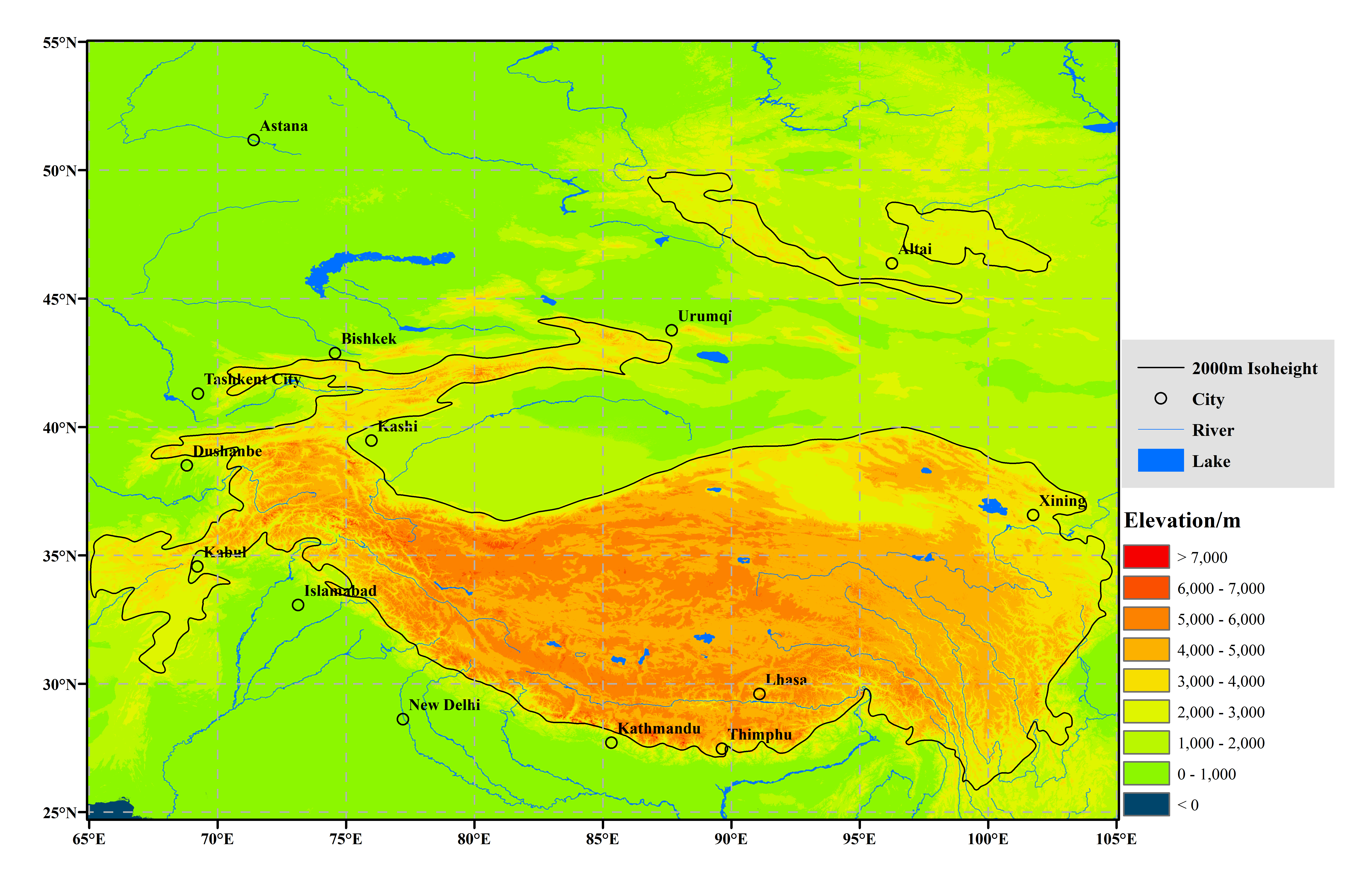
The mandate of the TPRCC-Network is to provide services to an area centred on Qinghai-Tibetan Plateau (QTP) and extended, from Pamir and the Hindu-Kush in the west to the Hengduan Mountains in the east, complementing the existing RCC service functions of the RA II. As a result, the TPRCC-Network domain does not constitute a definition of the Third Pole, is intended for operational purposes, and may vary for different activities. Therefore, the geographical domain for contributions to and for the products and services of the TPRCC-Network has been loosely defined, allowing some flexibility for domain variation for different services, if needed. Based on the planning process of the TPRCC-Network and a large number of scientific researches in the High Mountain Asia region, as well as concerns of consortia and users, the domain of the TPRCC-Network covers a rectangular area of 25°N-50°N Latitude, 65°E-105°E Longitude, with a 2000 m contour line within this area highlighting the concept of high mountain, which is the mean altitude that the main rivers in the third pole region flow out of mountain passes. Additionally, considering the complexity of mountain areas and diversity of requirements by Members, products for sub-domains will be developed to deliver better services, and an appropriate variation to its boundary may vary based on the requirements of the countries in the Network’s sub-regional domains. The following basic consideration is hence highly recommended:
(1) To serve at regional level, with regional responsibilities by nature and not to duplicate or replace services provided by NMHSs;
(2) All relevant variables observed by consortia members being covered by the selected sub-region boundary;
(3) To extend the boundary appropriately from impact perspective.
Furthermore, during demonstration phase Nodes can explore whether there might be a need to expand/modify boundaries of their respective domains. Therefore, the domains boundaries will be finalized towards the end of demonstration phase.


